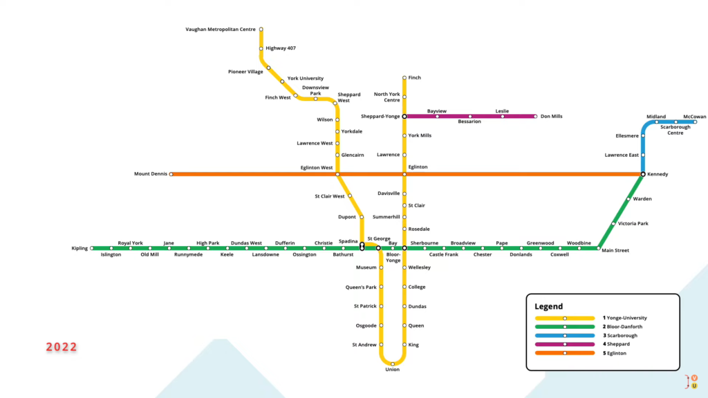
This is Toronto, Canada. Home to 2.7 million people, the city is connected by a network of subway lines, which serves 75 stations in two local municipalities.
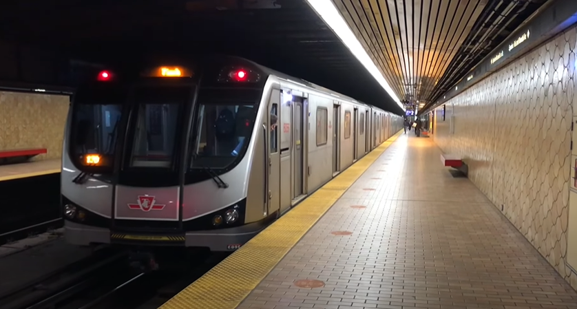
Consisting of four lines and 77 kilometres of track, the system travels along Toronto’s main arteries, with trains running frequently from downtown to the suburbs. But how did the system grow from its original station to the network it is today?
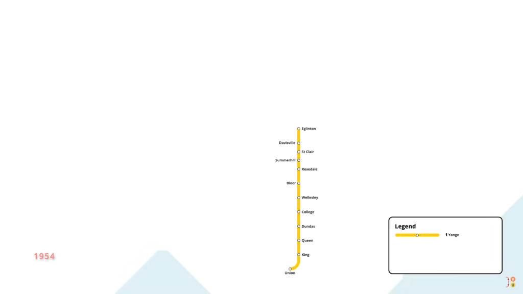
The first subway line opened in March 1954, as a 7.4-kilometre subway running underneath Yonge Street. The line serviced 12 new stations, with service running from Union to Eglinton.
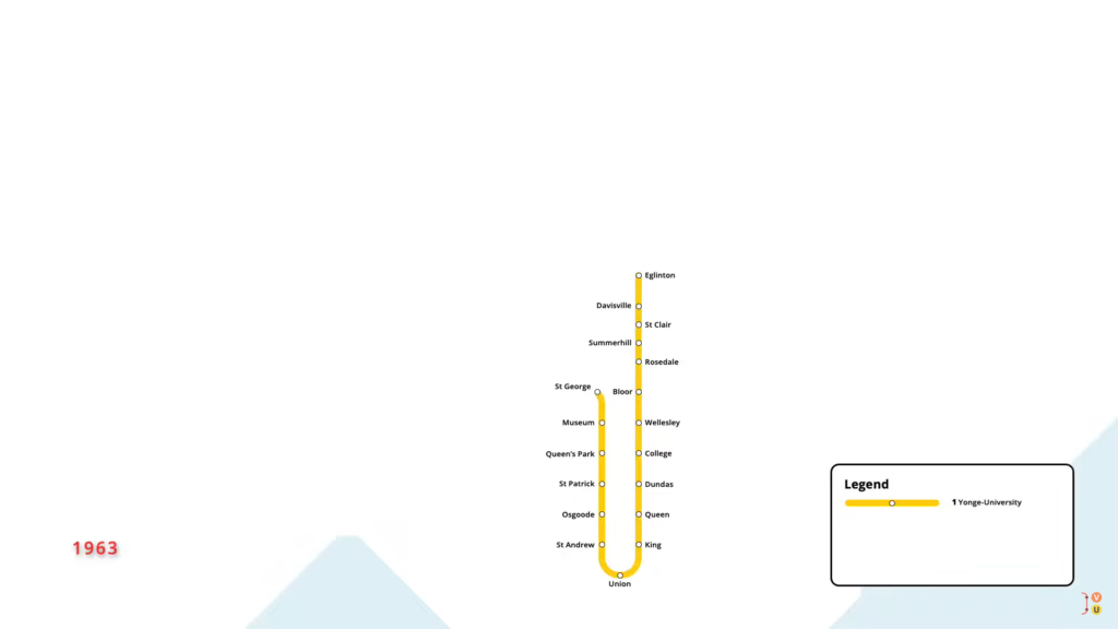
In February 1963, the subway was extended north under University Avenue, adding six new stations to St George.
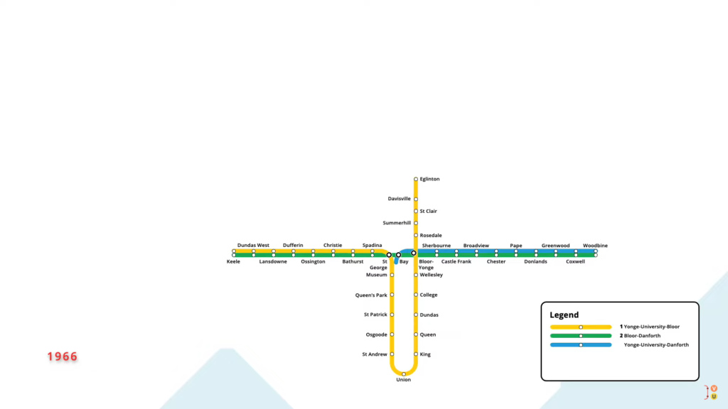
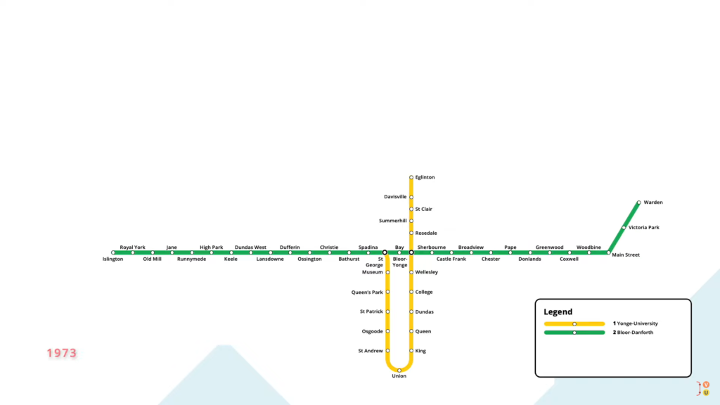
In February 1966, the subway was extended under Bloor and Danforth, servicing eighteen new stations along the corridor. Two new lines were inaugurated as part of this expansion, allowing passengers to travel between any two stations without needing to transfer. The new subway interchanged with the existing line at Bloor, which was renamed to Bloor-Yonge.
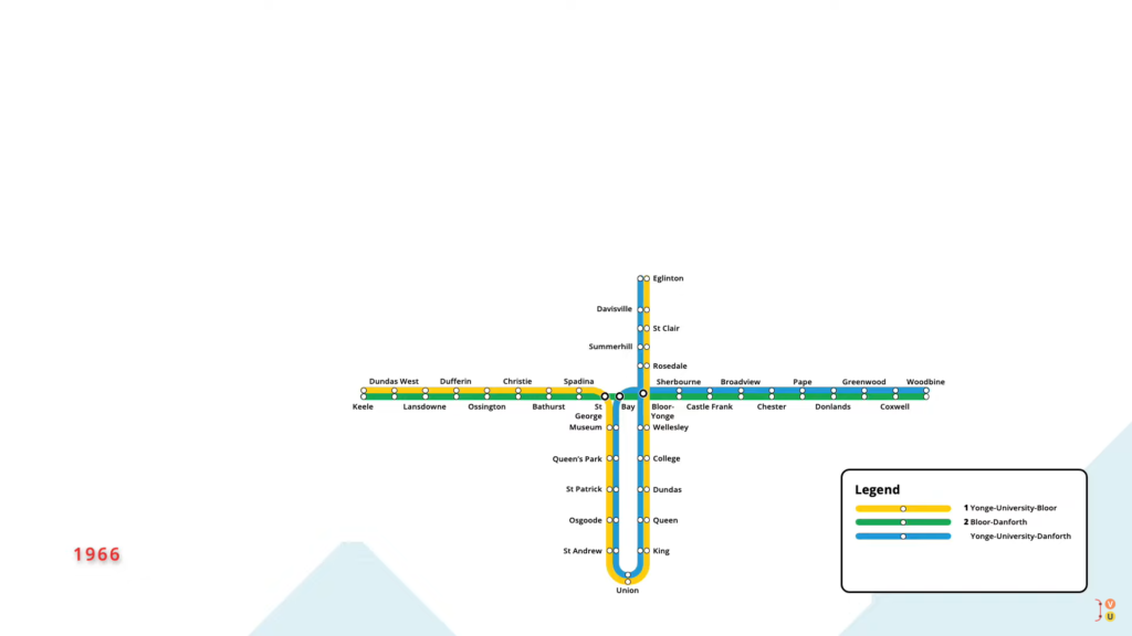
Six months later, however, the subway network was simplified, with a single line running from St George to Eglinton.
The second line runs between Keele and Woodbine.
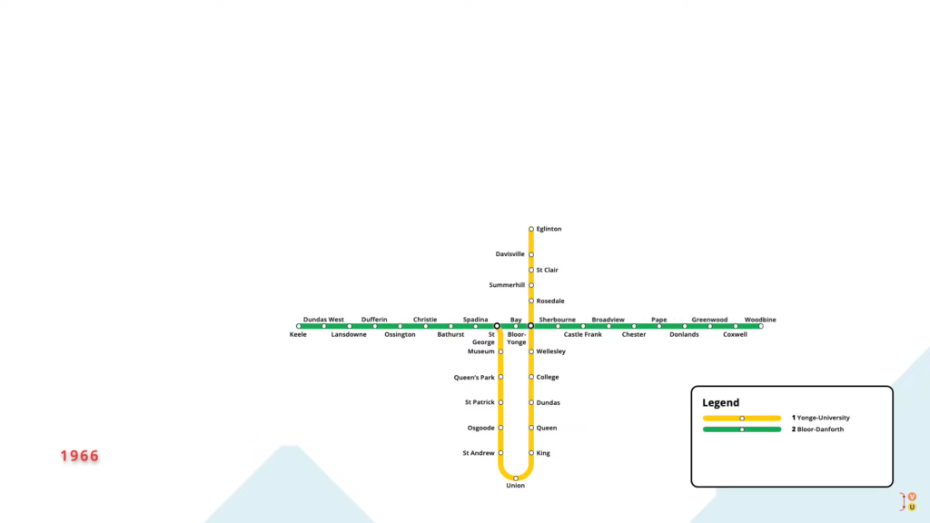
With this change, the second platform at Bay station was abandoned and remains unused to this day.
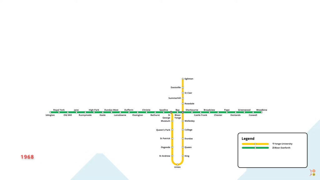
In May 1968, the Bloor-Danforth line was extended west from Keele, with six new stations opening to Islington.
On the same day, an eastward extension on the line also opened, with three new stations taking the subway to Warden.
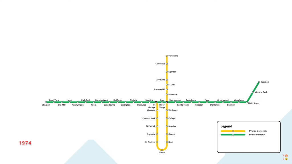
In March 1973, the Yonge-University subway was extended north from Eglinton, with two new stations opening to York Mills.
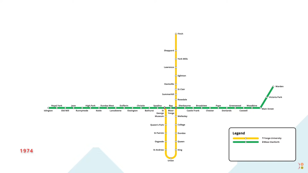
An additional two-stop extension of the Yonge-University line opened in March 1974, taking the subway north to its present terminus at Finch.
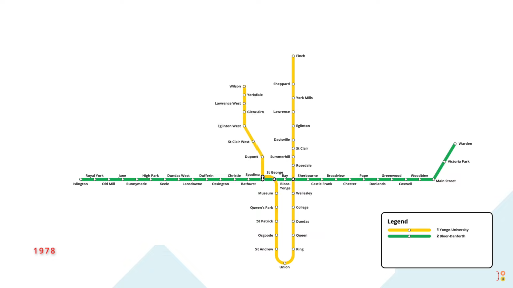
In January 1978, a new branch of the Yonge-University subway opened, extending the line north from St George. The extension included eight new stations north to Wilson, part of which ran in the median of a newly constructed highway.
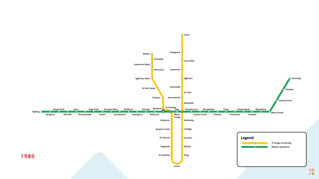
At Spadina, the station was connected to the Bloor-Danforth line via a walkway, allowing for transfers between the two lines. November 1980 saw two one-stops of the Bloor-Danforth subway open, taking the line to its present end stations. On the west end, a one-stop extension took the line to Kipling, while the east end saw a new station open at Kennedy.
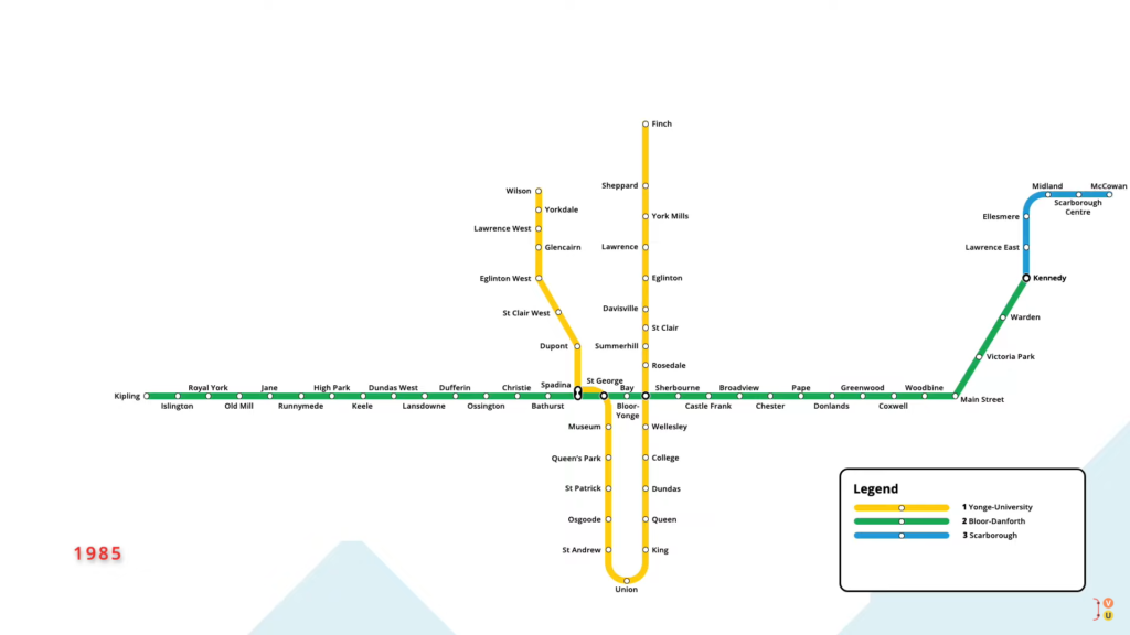
In March 1985, Toronto’s third subway line opened, in the form of a light rapid transit line in the east end of the city. The Scarborough line ran north from the terminus of the Bloor-Danforth Line at Kennedy, servicing five new stations to McCowan.
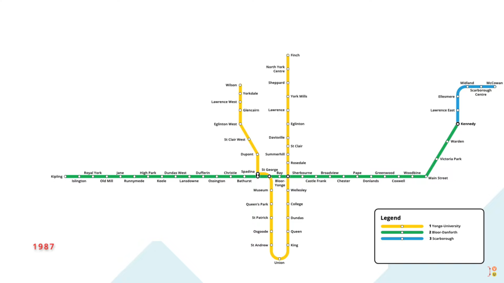
In June 1987, the Yonge-University line saw a new station open between Finch and Sheppard, at North York Centre. To this day, this is the only station that has been added to an existing subway line.
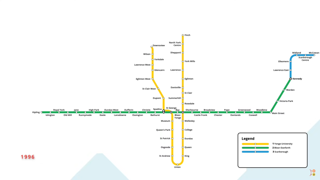
In March 1996, a one-stop extension on the opposite end of the Yonge-University line opened, taking the subway north from Wilson to Downsview. This was the first station on the network with elevators built into its design.
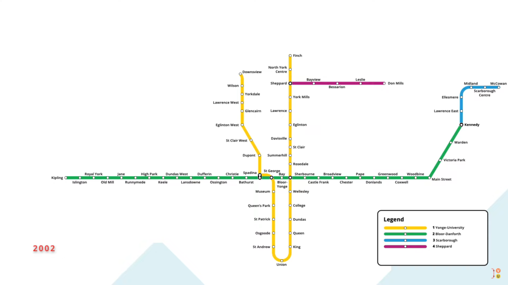
In November 2002, Toronto’s fourth subway line opened, running underneath Sheppard Avenue in the north end of the city. Running east from Sheppard station on the Yonge-University line, the subway serviced four new stations east to Don Mills.

With this new connection, Sheppard Station was renamed to Sheppard-Yonge, reflecting this new interchange station.
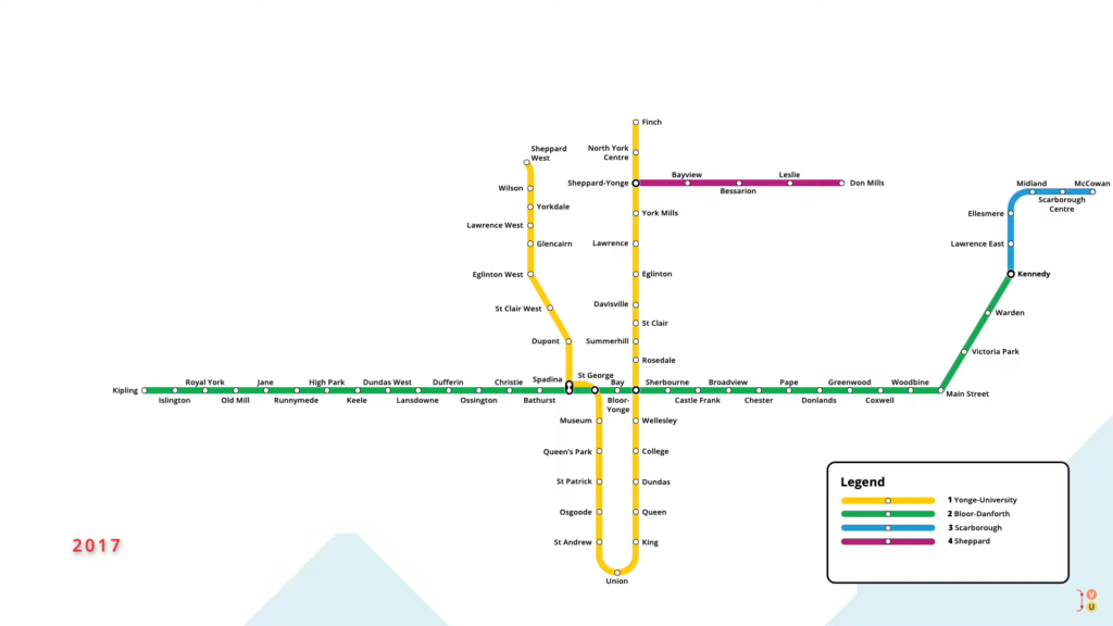
In May 2017, Downsview Station on the Yonge-University line was renamed Sheppard West, reducing a naming conflict with a future subway station.
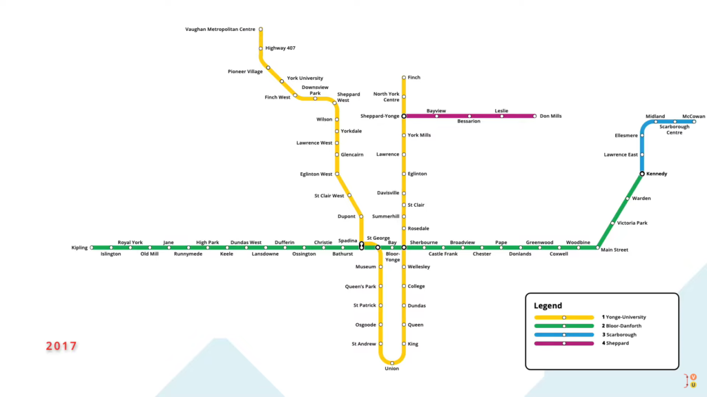
In December of that year, a six-stop extension of the Yonge-University line opened in the neighbouring city of Vaughan, taking the line north from Sheppard West to the Vaughan Metropolitan Centre.
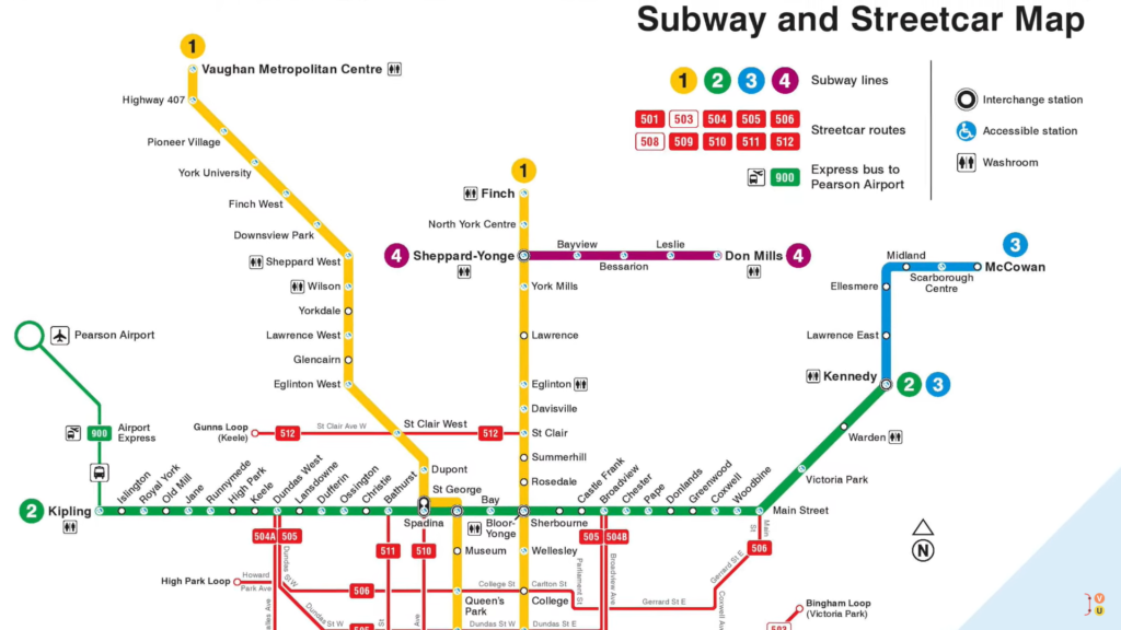
This brings us to the Toronto subway map that we know today.
In the years to come, two new light rail transit lines are expected to open, relieving pressure from some of the city’s busiest bus routes. In fall 2022, Toronto’s first light rail line will open on Eglinton Avenue, running west from Kennedy Station to a newly constructed stop at Mount Dennis.
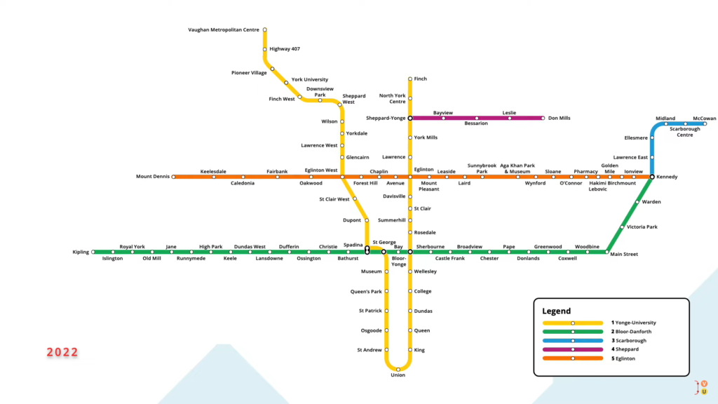
The line services ten street level stops from Ionview to Sunnybrook Park, before descending underground to service stations to Mount Dennis.
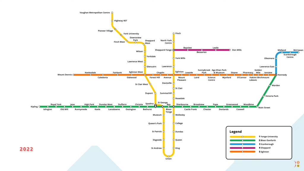
An additional underground station is located at the Science Centre, just east of Sunnybrook Park.

The line will interchange with the Yonge-University subway at Eglinton and Eglinton West stations, the latter of which will be renamed to Cedarvale once the new line opens.
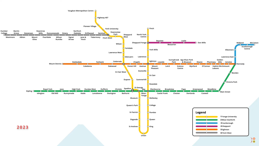
In late 2023, an additional light rail transit line will open, running west from Finch West Station on the Yonge-University line. The street-level line will service 16 new stops west to Westmore, before descending below grade to Humber College.
That was the evolution of Toronto’s subway network, giving us the four lines that we know today. Don’t forget to share this article with your friends on social media, getting more people to know this excellent Toronto Subway Network Evolution history.
Title: Toronto’s Subway Network Evolution